Aerial Terrestrial LiDAR Drone Mapping
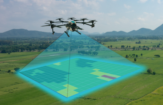
Aerial terrestrial LiDAR mapping services include helicopter laser scanning and drone remote sensing. Our new LiDAR drone system makes LiDAR topographic mapping affordable for even small project. Mapping LiDAR is a great choice for civil engineering projects, urban development, environmental conservation, and land surveying projects.
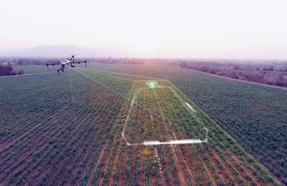
Our Drone LiDAR mapping services are perfect for civil engineering projects, land surveying projects, urban development, mapping natural disasters and environmental conservation. Mapping with Drone LiDAR saves time in the field which cuts project costs. Using our Drone LiDAR laser scanner system mounted on a Industrial Grade Drone allows us to complete large projects in a matter of days. These same projects may take weeks or even months to complete with conventional land surveying methods.
Drone LiDAR Mapping Services
Our Drone LiDAR mapping services are perfect for civil engineering projects, land surveying projects, urban development, mapping natural disasters and environmental conservation. Mapping with Drone saves time in the field which cuts project costs. Using our Drone LiDAR laser scanner system mounted on a Industrial Grade Drone allows us to complete large projects in a matter of days. These same projects may take weeks or even months to complete with conventional land surveying methods. This includes traditional land surveying equipment like robotic total stations and GPS (Global Positioning Systems). Drone LiDAR mapping services are a smart solution for topographic mapping.
In addition to remote sensing using a Industrial Grade Drone, we now perform aerial terrestrial Drone LiDAR mapping using a drone. We also use our new gas-powered drone for bathymetric Drone LiDAR services. This makes remote sensing or laser scanning affordable.
Drone LiDAR Hawaii Mapping
with Drone LiDAR
- Drone LiDAR Mapping your large project via Industrial Grade Drone saves time in the field.
- Drone LiDAR Drone Mapping is a cost-effective solution for Drone LiDAR Mapping.
- Drone LiDAR Mapping is perfect for topographic mapping, civil engineering projects, land surveying projects and urban development.
- Drone LiDAR Mapping produces active x, y, z data points which are AutoCAD + MicroStation compatible.
What is Drone LiDar?
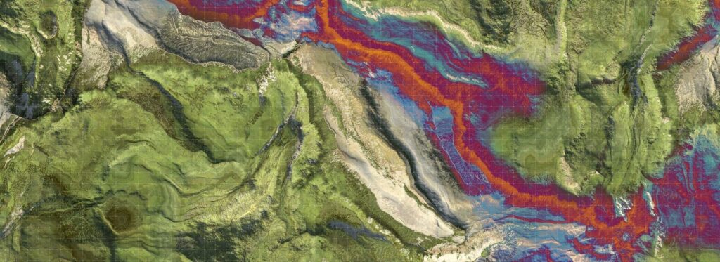
Drone LiDAR systems generate light from a rapidly firing laser for ground measurements. This light travels from the laser, penetrating foliage while reflecting off of things like tree trunks, rock outcroppings, and buildings. The reflected light energy returns to the Drone LiDAR sensor where it is recorded.
A Drone LiDAR system measures the time it takes for emitted light to travel to the ground and back. This time is used to calculate the distance traveled. Distance traveled is then converted to elevation. Drone LiDAR system measurements are made in conjunction with GPS systems and satellites to identify the actual x, y, z location of the light energy while an IMU or Internal Measurement Unit provides the orientation of the plane, Industrial Grade Drone.
SHOALS Bathymetric LiDar
SHOALS aka Scanning Hydrographic Operational Airborne Lidar Survey systems were developed as a tool for monitoring nearshore bathymetric environments by the U.S. Army Corps of Engineers. SHOALS systems are used in tidal inlets for collecting data on channel shoaling, changes in shape of ebb and flood tidal shoals and the patterns of sand movement. SHOALS is also used for coastal structure evaluation, protecting shorelines and coastlines, natural disaster emergency response, navigation, and nautical charting.
SHOALS systems are very large and very costly. SHOALS systems must be mounted on a full-size aircraft in order to do bathymetric LiDAR data collection. This cost of the system in addition to the cost of the aircraft makes using a SHOALS systems cost-prohibitive on most commercial projects.